 |
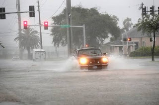
| Devastating effect of Hurricane Harvey |

Time is running out to evacuate and prepare for Hurricane Irma, officials warned as violent winds and rains from the Category 3 storm began pounding the southern tip of Florida.
The first hurricane-force wind gust of 74 mph was recorded in Key West, the National Weather Service says.
Irma’s powerful winds and outer rain bands lashed the Florida Keys as the massive storm slowly began turning from Cuba’s northern coast up into the Florida Strait, the National Hurricane Center says.
With maximum sustained winds of 120 mph, Irma is expected to strengthen once it moves away from Cuba, with the possibility of hitting the US mainland as a Category 4.
Irma’s eye is expected to be near the Florida Keys Sunday morning before driving up the state’s southwestern coast in the afternoon, according to the hurricane center.
Meanwhile, Hurricane Irma is now a Category 4 hurricane with maximum sustained winds of 130 mph. It is expected to make landfall over Key West around 7 a.m. Sunday, before moving up Florida’s west coast in the afternoon, the National Hurricane Center says.
Its outer rain bands lashed the Florida Keys late Saturday. A hurricane-force wind gust of 74 mph was recorded on Key West.
Key West residents tell CNN there was flooding on the city’s streets early Sunday and KEYS Energy Services said all 29,000 of its customers — from Key West to the Seven-Mile Bridge — had lost power.
Source: CNN


